


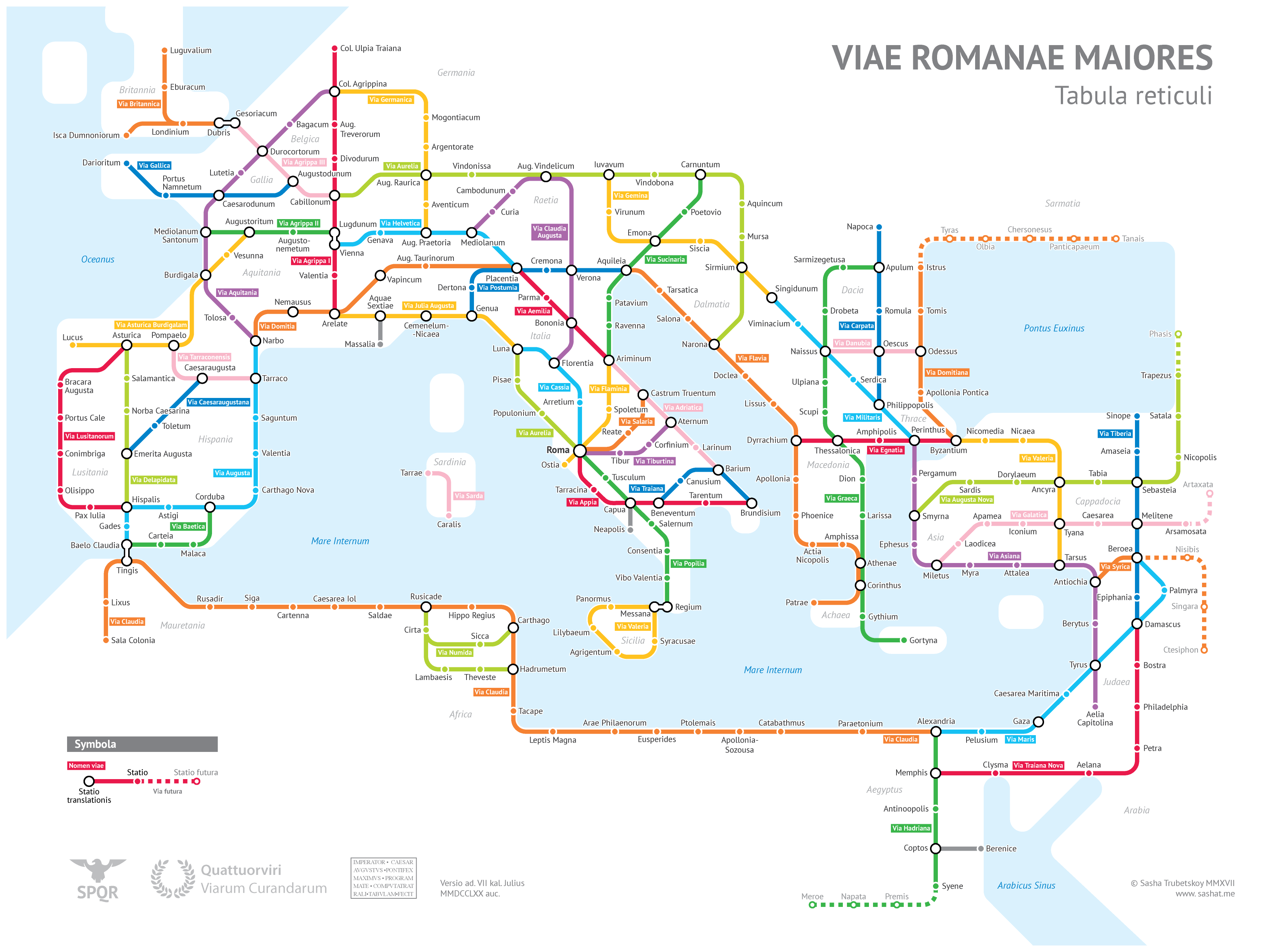
The roads that connected key cities of the vast empire have been reimagined as Metro lines in the map by Sasha Trubetskoy, a statistics student at the University of Chicago.
On the map, ancient cities become subway stops, connected by well-known road routes such as the Via Appia which linked Rome with Brindisi, as well as lesser-known roads.
“I’ve always had an interest in Ancient Rome, starting from when I read Asterix as a little kid,” the designer told The Local.
“I had the spontaneous idea to model the ancient road network in a modern style. I was motivated by a desire to produce a high-quality transit-style map, unlike all the poorly designed maps I’ve been seeing online,” Trubetskoy explained.
Trubetskoy used old maps of Ancient Rome and based his work on the empire at around 125 AD, though he also outlined the ‘creative liberties’ he took in his design, including inventing names for roads which don’t have a known name and leaving out smaller cities to avoid overcrowding the map.
He also shared an alternative version of the Roman Roads map on Twitter, inspired by London’s Underground network.


